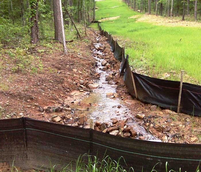
Sediment and Erosion Control

FTN has provided engineering design and construction observation services for several midstream companies in Arkansas on more than 150 miles of pipeline rights-of-way for the design of erosion and sediment control measures. The work included the development of a Best Management Manual and included determining the appropriate control measures on a site-by-site basis. Our firm’s onsite… Read more »

Read More

Restoration and Streambank Stabilization

Approximately 700 ft. of Pleasant Ridge Road on the east edge of Rogers, AR., was experiencing failure or was at immediate risk of failure. The primary contributing factors were the rapid incision and bank erosion of a stream channel adjacent to the road.   FTN provided the following services for the restoration of the streambank:… Read more »

Read More

Stormwater GIS Database Work Plan

The Pulaski (AR.) Area GIS (PAgis) selected FTN to develop a formalized work plan document to address the processes and procedures, standards, estimated costs, roles and responsibilities, and other items necessary for completing and maintaining the Stormwater Geographic Information Systems (GIS) database.   The initial steps in developing the plan for the completion of the… Read more »

Read More

MS4 Mapping and Drainage Study Support

Sherwood, AR., contracted FTN to assist with mapping the City’s Municipal Separate Storm Sewer System (MS4) as required by the city’s MS4 General Permit and to gather information to be used for additional drainage studies. The MS4 map must include the locations of all outfalls from the MS4 and the names and locations of surface… Read more »

Read More

Update of Low Impact Drainage Manual

Fayetteville, AR., has experienced significant growth in residential, commercial and infill developments over the past decade. In an effort to minimize environmental impact and encourage green infrastructure, the city developed an engineering low‑impact development (LID) guidance manual for individuals and developers. Some existing city ordinances and typical drainage design approaches described in the drainage criteria… Read more »

Read More

Letters of Map Revision

Three separate projects were completed by our firm to prepare Federal Emergency Management Agency Letters of Map Revision (LOMRs) in Bentonville, AR., and portions of unincorporated areas in Benton County. These LOMRs were initiated by the city to update approximate Zone A special flood hazard areas to areas of detailed Zone AE with published base flood… Read more »

Read More